Tag Archives: land use

Seminars CLXXVII-CLXXIX: animals in Byzantium, Christians under Islam, Byzantines in Israel

As promised, this week I want to do a bit more old-style seminar reporting. I’m not getting out to seminars the way I once did, and wasn’t even in early 2021, our current point in my backlog, but sometimes if you’re in the right place the seminars come to you, and sometimes Leeds is that place…

Manuscript page showing "Isaac" Tzetzes offering his Scholia in Lycophronis to Christ

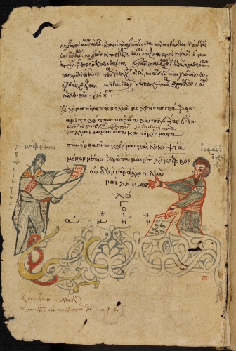
Heidelberg Universitätsbibliothek Cod. Pal. Grace. 18 fol. 96v, showing "Isaac" Tzetzes offering his Scholia in Lycophronis to Christ, this misnamed 13th-century depiction being the only one there is of our next subject

In the first instance that was slightly less surprising because the speaker was Dr Maroula Perisanidi, who had been working for us for some time by this point and was shortly to become an established member of our staff! But with that still in the future, on 26th January 2021 she was presenting to the Institute for Medieval Studies Research Seminar with the title, “Animals and Masculinities in the Letters of John Tzetzes”. I had not heard of this particular twelfth-century scholar before, but Maroula made him out as a very sympathetic character for an 21st-century western audience: he thought competitive warlike masculinity was silly (as do many of us who feel we would be bad at it, I guess, but that doesn’t always stop us responding to challenges…) and that real intellectual endeavour was a non-competitive and largely inward pursuit; and he was almost always short of cash or support.1 Furthermore, and Maroula’s key point, his letters are full of the love of animals: he hated hunting; he kept pets and mourned them when they died (and pointed to significant warleaders who had done likewise as proof that this was a perfectly masculine thing to do); and he argued that animals were better than people in lots of ways, not limited to but definitely including their superior senses. I did notice that in Maroula’s instances Tzetzes seemed most ready to liken himself to the phoenix, the lion, the kite, etc., rather than the mouse, louse or rabbit, but that doesn’t make his positions any less striking. Questions were naturally raised about whether he was weird, and to that Maroula reckoned that rejecting hunting was quite common but that in the rest of it he might be more unusual. Emilia Jamroziak reminded us of the trope in saints’ lives (and before, with Androcles and that) of the animals which help the worthy, but Maroula thought Tzetzes gave the animals their own agency in making his points; it was their normal animal life he used, not their narratively-necessary bits of interaction with humans. There was lots left to work out, and I guess that is still going on, but as what we might call "serious entertainment" this was a winner of a paper.2

Exterior of the Church of the Holy Sepulchre, Jerusalem

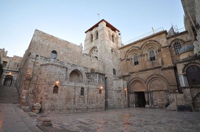
Exterior of one church which certainly was rebuilt under Islam, the Church of the Holy Sepulchre. Photo by http://www.flickr.com/photos/jlascar/http://www.flickr.com/photos/jlascar/10350972756/in/set-72157636698118263/, licensed under CC BY 2.0 via https://commons.wikimedia.org/w/index.php?curid=30052661

The next paper I want to record was one that it’s possible I caused. At least, back in the days of physical meetings and the Institute for Medieval Studies Public Lectures, which went away during the high pandemic for obvious reasons and never came back, I put on one of the feedback sheets they used to hang out something to the effect of, “What about Janina Safran?” No-one subsequently mentioned this to me, but when I later learned that on 23rd February 2021 Professor Janina Safran was in fact presenting to the same seminar, with the title, "Reading Fatwas into History: ‘Let Every Religious Community Have its House of Worship’", I couldn’t help but wonder. In any case, Professor Safran, whose work on divisions and interactions between religious and social groups in Islamically-ruled communities has been quite important over the last few years, was doing some more of that, and her specific questions were about Christians and Jews being allowed to rebuild churches or synagogues, respectively, or indeed build new ones, where Islam ruled.3 It’s all too easy now to look this up and find someone citing that rather difficult pseudo-document, the Covenant of ‘Umar, as proof that this just wasn’t and isn’t allowed.4 But as Professor Safran quickly showed, there has never been agreement across Islam about this issue (or about what the Covenant of ‘Umar is, for that matter), and even if there had been, the mass displacement of communities from the collapsing Muslim states in the Iberian Peninsula to Africa and vice versa in the twelfth to fifteenth centuries (CE) would have brought the issue to a head as existing community resources were swamped or abandoned in each case.5 Professor Safran had found a range of Islamic scholars each with a different opinion: about the only thing they all agreed on was that bell-ringing was not allowed, but for some there was neither building nor repair allowed because Christians were a treacherous fifth column (apparently the opinion of Ibn Rushd, even though modernity loves to love him), for some repair but not expansion (al-Burzulī), for some necessary expansion but not new building (Ibn al-Hajj, Professor Safran’s main source for the paper) and for some even new building was allowed if no Muslims were there to see it (and likewise the only places bells were OK were where there were no Muslims to hear). And of course, all of this was coming before jurists because the thing was happening anyway and people were consulting them over whether it was legal, or we’d not have the fatwas (rulings); but that also means people weren’t sure. Since each specific pact with a Christian community was individually negotiated at conquest, as long as they had surrendered, there was even the question of whether general legal rules could or could not overrule particular concessions, and most agreed that they could not. We lost Professor Safran to internet patchiness before we got to the conclusion, but recovered her for questions and had by then already accumulated quite a rich picture of the bitty, cumulative and sometimes contradictory way in which Islamic law developed and develops. People who get worried about the iron force of sharīʿa might take some comfort from medieval illustrations like these of how it actually got and gets worked out in practice.

Mosaic floor in the 3rd-century synagogue at Kibbutz Ein Gedi

Mosaic floor in the 3rd-century synagogue at Kibbutz Ein Gedi, image from the Madain Project and linked through to them

Lastly, not a medieval paper at all but one which turned that way suddenly in questions, on 24th February 2021 another Leeds colleague, Dr Nir Arielli, was presenting to the School of History Research Seminar with the title, “Life Next to the Dying Dead Sea: a social-environmental micro-history of Kibbutz en-Gedi”. This, I attended largely because some months before Nir and I had warmly agreed that there needed to be more work on land use in the School of History and thus I felt that, when he was then doing that, I should probably support. The land use in question, however, is at great risk because of the way that the Dead Sea has shrunk over the last few decades, largely if not entirely because of extraction for industry from the River Jordan by many countries.6 The pictures were dramatic and worrying, but the hook for this medievalist listener came from the fact that, among its other work on the site, the Kibbutz has found and attempted to frame itself as the revival of a Roman-period Jewish village. This rang bells for me because of the work of Dan Reynolds about the historicization to political purposes of Roman- and Byzantine-period use of lands in these areas, but I restricted myself to asking how long the Roman settlement had lasted and what was known about it by the Kibbutz community.7 Even that was quite interesting: the site had a synagogue, with a mosaic floor that you see above which very handily identifies itself, a Cave of Letters connected with the Second Jewish Revolt whose records include the court cases of a a litigious second-century woman called Arbatta, among the other victims of the Roman suppression of the rebellion, and other remains that indicate the place was occupied until the seventh century. I don’t know what happened then and all likely answers would probably be bad at the moment, but it was certainly easy enough to understand why the modern community had built themselves a museum for this stuff and interesting that the past was so literally central to the place and its settlers’ identity. There were lots of other more relevant questions as well, of course, but I felt as if I’d got the medieval to show itself in my modernist colleagues’ work for a moment and therefore went away well satisfied as well as more educated. Which, I suppose, is ideal for a day in a university environment!


1. If one is in need of an introduction to Tzetzes, other than the man’s own X feed already linked of course, one might try Enrico Emanuele Prodi, "Introduction: A Buffalo’s-Eye View" in Prodi (ed.), Τζετζικλι Ερεϒνλι, Εικασμος: Quaderni bolognesi di filologia classica, Studi online 4 (Bologna 2022), pp. ix–xxxv, online here, but I admit I haven’t so can’t be sure what you’d get.

2. If you can’t wait till this emerges, you could sate yourself meanwhile with Maroula Perisanidi, "Byzantine Parades of Infamy through an Animal Lens" in History Workshop Journal Vol. 90 (Abingdon 2020), pp. 1–24, DOI: 10.1093/hwj/dbaa019; and the phrase "serious entertainments" is famous to me because of Nancy F. Partner, Serious Entertainments: The Writing of History in Twelfth-Century England (Chicago IL 1977).

3. Professor Safran was known to me when I scrawled that request for work such as Janina M. Safran, "Identity and Differentiation in Ninth-Century al-Andalus" in Speculum Vol. 76 (Cambridge MA 2001), pp. 573–598, DOI: 10.2307/2903880; Safran, "The politics of book burning in al-Andalus" in Journal of Medieval Iberian Studies Vol. 6 (Abingdon 2014), pp. 148–168, DOI: 10.1080/17546559.2014.925134; and Safran, Defining Boundaries in al-Andalus: Muslims, Christians, and Jews in Islamic Iberia (Ithaca NY 2015).

4. See for example David J. Wasserstein, "ISIS, Christianity, and the Pact of Umar" in Yale University Press Blog 16 August 2017, online here.

5. Further doubts about the application of the Pact can be found in Norman Daniel, "Spanish Christian Sources of Information about Islam (ninth-thirteenth centuries)" in al-Qanṭara Vol. 15 (Madrid 1994), pp. 365–384, which includes apart from anything else a demonstration that there is no evidence for the Pact being known in al-Andalus.

6. See for more Nir Arielli, "Land, water and the changing Dead Sea environment: A microhistory of Kibbutz Ein Gedi" in Journal of Israeli History: Politics, Society, Culture Vol. 40 (Abingdon 2022), pp. 235–256, DOI: 10.1080/13531042.2022.2186311.

7. Daniel Reynolds, "Conclusion: Post-Colonial Reflections and the Challenge of Global Byzantium" in Leslie Brubaker, Rebecca Darley and Daniel Reynolds (edd.), Global Byzantium: Papers from the Fiftieth Spring Symposium of Byzantine Studies, Publications of the Society for the Promotion of Byzantine Studies 24 (London 2022), pp. 372–409, DOI: 10.4324/9780429291012-20 at pp. 376-391.

What to remember from the 2018 International Medieval Congress?

Although I feel that it probably is a sign that I am catching up on my blogged past, I have to admit that I face the fact that the next thing in my blog pile is the International Medieval Congress of three-and-a-half years ago with a certain unwillingness. I mean, I’ve spent much of the last two years either trying to stay off or being told I can’t go onto the campus where it happened, for a start, so there is definitely a sense that this is deep past which doesn’t have so much to do with time as experience. But I’ve done all the rest and the format for them seems pretty well worked out now, and so I will give it a go.

Postcard advertisement for the International Medieval Congress 2018

Postcard advertisement from the IMC website

This was, I am reminded as I fish the programme off the shelf, the 25th International Medieval Congress, and the programme is the fattest of all the ones on that shelf. I can’t actually work out how many sessions there were: it says that there were 392 sessions on the conference theme of Memory, 9 keynote lectures and 394 further sessions, plus 4 lectures, so I think it’s 799, but firstly I’m not sure if that was everything and secondly, that was the programme as initially published, not the result of all the subsequent changes you find in the also-thick booklet of changes when you register. And in any case, however many sessions there are, you still can’t go to more than 17 because that’s how many slots there are in the programme, which is massively parallel, and most delegates won’t manage that because of their feeble needs for food and sleep or because of wisely placing socialising with people you otherwise never see over more direct forms of academic engagement. I do like, however, how this means that it’s probably mathematically possible for more paths through the Congress to exist than there are attendees, since there were this year 2,545 attendees and, if my GCSE maths does not fail me, 1 x 53 x 1 x 54 x 54 x 13 = 2,009,124 possible combinations of sessions just on the Monday not including any of the receptions. How would we know if it got too big? Anyway, this just means that what I have done the last few times, just listing my own path and then offering a few remarks where things still stand out for me, seems like the best approach still, because I can’t give an impression of 2 million plus possible other Congress experiences in one blog post, now can I? So mine is below the cut, day by day with brief commentary on each day to lighten the data dump. As ever, I’m happy to try and answer questions about the papers if people have them, but I will try and stay short unless you do. Here we go! Continue reading

Changing Ways to Read a Graph of Landlordship

A day early and about four years late still, here is this week’s post. While in the very last days of my previous bout of research leave, in late 2017 and early 2018, I was reading my way through the various Italian polyptychs and inventories in a 1979 volume edited by Castagnetti; two of them actually contain crop yields data, only one of which I’d known about, and I wanted to make sure that I found any more.1 Now, there weren’t any more but there were a lot of references to a couple of early articles by David Herlihy. Herlihy was a bit of a legend, mainly for his work on town and women’s life in later medieval Italy but he also did a rook of short articles in the late 1950s to early 1970s on the basis of a huge database of published charter material he’d assembled somehow, and some of those articles are still really big in the literature. If you’ve ever seen a claim that in the Middle Ages the Church owned up to a third of all land, for example, that was Herlihy, and he also stands out as one of the first people to point out that actually female landownership is not uncommon in medieval documents, which gathered him a small raft of students who have become important gender historians, mainly because he was willing to see what was there.2 So I’ve always thought that Herlihy was not a bad model for the kind of historian I’d like to be, and when I catch references like these to work of his I’ve not read, I try and follow them up. And in one of these, there is this graph.3

Graph of types of rents in northern and central Italian charters 751-1200

David Herlihy, “The History of the Rural Seigneury in Italy, 751-1200” in Agricultural History Vol. 33 (Washington DC 1959), pp. 58-71 at p. 60

Now, if there is a weakness in these early articles of Herlihy’s it’s a tendency to proffer a single explanation and then cover no alternatives, which is why he could do in twenty-five pages what would take most people a book, I guess, and this is no different. Here Herlihy argued that money rents were the weak landlord’s option compared to service, since commutation to money deprived him of guaranteed labour and foodstuffs and subject him to the market (Herlihy liked the market, so he didn’t say that last bit, but it’s implicit). They also broke the closeness of a landlord’s connection to his tenants. For all these reasons, for Herlihy what this graph shows was a tightening of landlords’ control under the Carolingians and then its loss as the Italian kingdom disintegrated in the late ninth and early tenth centries, accompanied by an increase in tenurial fragmentation which he thought he’d showed in a previous article, till the economy was in genuine crisis, with which various ‘vigorous’ landholders dealt by consolidating holdings in aggressive campaigns of acquisition and subjection. But we should see those as a good thing! because they revitalised the agrarian economy and allowed the development of towns and government and developed economies and the Renaissance and so on.4 That last bit makes me wish to be Herlihy a bit less, I admit, but it’s an impressive bit of theorisation of massive changes from one graph. But there are times when a graph is not enough…

Ph.D. Comics for 13th February 1998

Ph.D. Comics for 13th February 1998. Admit it, you have seen this done in presentations

… and it’s necessary to ask what else might be going on here. As a self-denying numismatist, for example, one thing struck me straight away which is that you could, if you wanted to be equally careless, read this instead as a graph of monetisation of the Italian economy, by assuming that everyone would have used money if they could have, and so if they weren’t it wasn’t available.5 Certainly, Herlihy never really thought about money supply; he apparently just assumed it could be got if needed, but I’m not sure that was true in this era and in notes occasionally it becomes clear that neither was Herlihy, really.6 But it needs factoring in for his deductions to stand up. That is so not least because he stated an assumption that a shift to money rents automatically meant that the landlords were giving up on farming their manorial lands directly and breaking them up into tenancies because of no longer having labour available, but obviously that need not have been so if they were hiring labour instead, in which case of course they might have wanted money rents, because then they’d have been able to get work done when they needed it and not just when their peasants’ obligations came up.7 I don’t think that’s necessarily what’s happening in Herlihy’s graph but he certainly didn’t show any signs of having considered it.

Silver denaro of Emperor Otto I struck at Pavia in 956-73

The kind of money the peasants in question either could or could not get, a silver denaro of Emperor Otto I struck at Pavia in 956-973, image by FabioRomanoniown work, licensed under CC BY-SA 4.0, Wikimedia Commons

In the end, therefore, I like this article to think with and I’m always impressed how well Herlihy’s charter stuff holds its worth, largely because of being so directly data-driven, but what is maybe most interesting to me is the difference your starting assumptions make to how you read that graph. Herlihy had already detected what he thought was a break-up of landholding and an economic crisis that fitted this graph’s chronology; but the sadly late Peter Spufford would probably have seen signs of European silver famine here, a number of economic historians might prefer to see a growth of wage labour hindered by big bad feudalism and eventually triumphed over by the dialectical triumph of the capitalist market economy, and I’m not sure where I myself stand but it definitely comes from Pierre Bonnassie‘s and Chris Wickham‘s similar but differently-timed cases for a period of light obligations on the peasantry in the early or central Middle Ages.8 I suppose it’s a reminder that data may be neutral but its interpretation is another matter…


1. Andrea Castagnetti, Michele Luzzati, Gianfranco Pasquali and Augusto Vasina (edd.), Inventari altomedievali di terre, coloni e redditi, Fonti per la Storia d’Italia 104 (Roma 1979); see now Jonathan Jarrett, “Outgrowing the Dark Ages: agrarian productivity in Carolingian Europe re-evaluated” in Agricultural History Review Vol. 77 (Reading 2019), pp. 1–28 at pp. 16-19 & 25-26.

2. His greatest hits would probably be D. Herlihy, Pisa In The Early Renaissance: A Study Of Urban Growth (New Haven CT 1958); idem, Medieval Households (Cambridge MA 1985); and idem, Opera Muliebria: Women And Work in Medieval Europe (Philadelphia PA 1990); but one also has to list the two ground-breaking articles, idem, “Church Property on the European Continent, 701-1200” in Speculum Vol. 36 (Cambridge MA 1961), pp. 81–105 and idem, “Land, Family and Women in Continental Europe, 701-1200” in Traditio Vol. 18 (Fordham NY 1962), pp. 89–120, repr. in Susan Mosher Stuard (ed.), Women in Medieval Society (Philadelphia PA 1976), pp. 13–45. He also had at least one Variorum volume which must have collected these and others like them.

3. David Herlihy, “The History of the Rural Seigneury in Italy, 751-1200” in Agricultural History Vol. 33 (Washington DC 1959), pp. 58-71 at p. 60.

4. Ibid., pp. 68-69, almost as explicitly as I render it; the previous article was Herlihy, “The Agrarian Revolution in Southern France and Italy, 801–1150” in Speculum Vol. 33 (Cambridge MA 1958), pp. 23–41, again not a small-scale study.

5. For a really sane critique of these kinds of views, see Dagfinn Skre, “Commodity Money, Silver and Coinage in Viking-Age Scandinavia” in James Graham-Campbell and Gareth Williams (edd.), Silver Economy in the Viking Age (Walnut Creek CA 2007), pp. 67–92, effectively printed again as Skre, “Commodity Money, Silver and Coinage in Viking-Age Scandinavia” in James Graham-Campbell, Søren M. Sindbæk and Gareth Williams (edd.), Silver Economies, Monetisation and Society in Scandinavia, AD 800 – 1100: Studies Dedicated to Mark Blackburn (Aarhus 2011), pp. 67–91, whence online here.

6. Herlihy, “Rural Seigneury”, p. 68 n. 53 is a dismissal of an argument by another historian that depreciation of the coinage might explain the drop in rent value, which of course it might; Herlihy argued that the coinage was down by half but the rents went up tenfold, but here and ibid. p. 61 where he suggested that peasants would have struggled to convert all their crop to cash, he showed some awareness that money supply might be a problem, a problem which he otherwise blithely ignored, presumably because that observation was all he needed to support the idea that money rents were necessarily a poor option. We might now think differently about the monetisation levels of the Italian countryside, but admittedly we might also not; see Alessia Rovelli, “Nuove zecche e circolazioni monetaria tra X e XIII secolo: l’esempio del Lazio e della Toscana”, ed. Alessandra Molinari, in Archeologia Medievale Vol. 37 (Firenze 2010), pp. 163–171.

7. Cf. Herlihy, “Rural Seigneury”, p. 61.

8. Pierre Bonnassie, “D’une servitude à l’autre : les paysans du royaume” in Robert Delort (ed.), La France de l’An Mil, Points-Histoires H130 (Paris 1990), pp. 125-141, transl. as Bonnassie, “From one Servitude to Another: the peasantry of the Frankish kingdom at the time of Hugh Capet and Robert the Pious (987-1031)”, in idem, From Slavery to Feudalism in South-Western Europe, transl. Jean Birrell (Cambridge 1991), pp. 288–313; Chris Wickham, “La chute de Rome n’aura pas lieu”, transl. André Joris, in Le Moyen Âge Vol. 99 (Bruxelles 1993), pp. 107–126, published in English as Chris Wickham, “The Fall of Rome Will Not Take Place” in Lester K. Little and Barbara H. Rosenwein (edd.), Debating the Middle Ages: issues and readings (Oxford 1998), pp. 45–57, or Wickham, “Sul mutamento sociale ed economico di lungo periodo in Occidente (400-800)” in Storica: rivista quadrimestrale Vol. 8 (Firenze 2002), pp. 7–28, transl. Igor Santos Salazar and ed. Iñaki Martín Viso as “Sobre la mutación socioeconómica de larga duración en Occidente durante los siglos V-VIII” in Studia Historica: historia medieval Vol. 22 (Salamanca 2004), pp. 17–32; but cf. now Wickham, “How did the Feudal Economy Work? the Economic Logic of Medieval Societies” in Past & Present No. 251 (Oxford 2021), pp. 3–40, which I haven’t yet had time to internalise but threatens to change really quite a lot…

Working for San Salvatore III: what they got out of it

I have now gone on at great length about the polyptych of Santa Giulia di Brescia without really talking about my actual purpose in reading it, so it’s time to do that.1 You may remember a long time back that I had a go at the idea, repeated in textbook after textbook, that agriculture in the Carolingian period ran at yields hardly more than the grain that was sown.2 This is self-evidently ridiculous if you are familiar either with actual growing of crops (which I am only second-hand) or can do basic maths, but it persists, and the reason it persists, like many another medieval cliché, is Georges Duby.3

Georges Duby

The late Georges Duby

This is not entirely Duby’s fault. He wrote a couple of textbooks in the 1960s and 1970s that somehow remain the world standard for any history of the early medieval economy that actually contains agriculture, and he used the best thinking available and sources known at the time.4 He did a pretty good job of synthesis on that, and though one might wish he’d thought about it a bit harder, it’s really not just him who’s failed to do so, and those that have thought about it haven’t really looked hard enough at his evidence.5 That was, in large part, the Carolingian estate survey of the fiscal centre at Annapes preserved in the text known as the Brevium Exempla, and some time ago already now I gave a paper at Kalamazoo in which I showed that Duby had in fact read the text wrong, or rather failed to read all of its data, as had all those he used, even, I’m sorry to say, Philip Grierson, and I considered that dispatched and proceeded to writing it up.6 But Annapes was not Duby’s only source that seemed to support these awfully low yields, and so I needed to see if the same tricks could be performed with the others too, and you will by now have guessed or maybe already know that one of them was the polyptych of Santa Giulia di Brescia.

Santia Giulia di Brescia from the air

Santa Giulia di Brescia as it now stands, from the air

Duby dealt with the figures from Santa Giulia only in summary fashion. In Rural Economy and Country Life he works Annapes over extensively, coming up with output figures of between 1·5:1 and 2·2:1, and then goes on:

“We must not, of course, generalize from one set of figures obtained from a single source. But it is possible to find elsewhere some other traces of output, somewhat higher than that which can be derived from the Annapes inventory, but even so representing a low yield and a derisory rate of profit when compared with the value of the capital in land and seed corn. One significant fact is that compilers who visited the farms (cours [apparently left in French from Latin ‘curtes’]) of the abbey of San Giulia of Brescia in 905-906 to compile a polyptych found there reserves of grain in the barns which were barely higher and sometimes lower than the quantity needed for sowing. Thus at Prozano where the fields could take 300 muids of seed corn, the stocks in the estate barn amounted to only 360 muids of which 140 were of millet (mil). At Canella 90 muids were needed for sowing and 51 were in the barns; at Temulina 32 and 37.”

And with that he moved onto Saint-Germain-des-Prés near Paris and pulled a similar trick there.7 And in the slightly later and much shorter Early Growth of the European Economy he didn’t even give that much detail (or a reference to the primary source), limiting himself to dealing again with Annapes and then adding:

“The Lombard monastery of St Giulia of Bréscia [sic], which consumed some 6,600 measures of grain annually, would have 9,000 sown to cover its needs, which means that the return normally available to the lord was being estimated at 1·7 to 1.”8

The best way to see what is wrong with this is to look closely at how the compilers of Santa Giulia’s polyptych were using their figures, figures that I’ve already argued here they were receiving in a standard format. And doing so shows firstly that Duby, and Luzzatto before him, were again wrong in assuming that these figures mean what they wanted to mean, and in fact that using them to calculate yield is impossible except in one single case where the formula was bent, and in that case it comes out at at least 4·25:1 and probably rather higher. Don’t believe me? Watch this! Continue reading

Working for San Salvatore II: specialists and individuals

As I said in the first post about the polyptych of Santa Giulia di Brescia, one of the things about its information that can’t fail to strike one is the variation within the standard form of record the monastery was using. This is obvious in terms of size, for one thing. The largest estate here, Alfiano, had enough arable land to sow 900 modii of grain in, 100 amphorae‘s worth of vine, meadow for 50 cartloads of hay, wood where 700 pigs could forage, a stud for breeding horses with 35 on hand, 37 head of cattle, 100 pigs, 3 mills, 3 boats and 40 tenants, as well as a staff of 8 magistri “for making walls, house and barrels”, and that’s not counting either its chapel whose properties were listed separately or a dependant estate whose return seems to have turned up late and been tacked on at the end of the survey.1 A place near Brescia called Palleriana had arable for 8 modii, vine good for 8 amphorae, meadow good for 8 cartloads, 2 cows, 2 tenants and 1 vacant lot, and that’s about it, which is to say that it was between one and two orders of magnitude smaller than Alfiano in the terms about which the monastery cared.2

Castello di Cavriana

This is neither of those places, but the castle at the centre of the estate whose returns I used in the dummy form of last post. I never thought of looking for an image! But this is the Castello di Cavriana. By Massimo Telò (Own work) [CC-BY-SA-3.0], via Wikimedia Commons.

You might ask what was worth even having about the latter place, then, and that opens up another question of variation, because of the vacant lot. I’m translating sors absentia here, but when they turn these clearly weren’t vacant in the sense we would assume in English, because they rendered produce, and often quite heavily, so I guess that what was going on here was that the the monastery allowed people who lived elsewhere, maybe the estate’s other tenants but not necessarily, to work them in exchange for rendering a cut of the produce to the monastery. That seems to be how they ran their mills and their landing-places, too, and the mountain-top lands they don’t really enumerate: all of these rendered in food and/or money, what suggests that the people who worked them were taking at least as much home themselves, and since the guys turning up at the landing-stages with salt and grain were presumably not all monastic dependants, I don’t really see why the farmers all need to have been either.

Anyway, at Palleriano the vacant lot rendered 7 modia of grain, 6 denarii and, most importantly, 80 pounds of oil a year from its olive-groves. That was presumably what made a pied-à-terre at Palleriano worth maintaining; the ordinary renders from the place were presumably not worth nothing but the monastery’s real interest there was probably letting people make oil in the bits of the estate they didn’t actually have the manpower to work. At Alfiano, by contrast, though nowhere else in the polyptych was breeding horses (and indeed only one other place even had any), there were apparently no olive-trees. The monastery had both estates organised in roughly the same way, with a staffed reserve run by workers living on hand-outs and a system of allotments held by people of various statuses on markedly varying terms—a bipartite organisation, in other words—but the actual use they got from these estates was very different.

Obviously some of this variation must have been purely geographical. Alfiano, which maybe covered most of the area inside the road route marked above, could run boats because it was on the Fiume d’Oglio, but apparently it was not good land for olive trees. Lots of other estates in the survey also have these specificities: very few places grew chestnuts, for example, only a very few rendered rushlights and the most obviously constrained resource is iron, which a few estates had and rendered lots of and most did not, obviously rather less by choice than by necessity: if there’s no iron ore in your chosen lump of Italy, you can’t really get it out.3 Some of the variation probably was by choice, though. There are massive variations in the balance of crops in store, for example, with rye sometimes being the bulk of it, sometimes millet or sometimes corn (frumentario), and that was presumably as much down to somebody’s choices about what to grow and what to take from store as it was what would grow, though certainly some of these crops do better in some kinds of soil than others. Goats are much rarer than sheep, though, and that must be by choice because there’s basically nowhere you can’t put a goat (except in as much as you might want to keep whatever you were growing there).

A rural homstead in Alfiano Natta, near Brescia

A house that was at time of writing for rent in the Alfiano region. Apart from the second stories and (obviously) the swimming pool, this doesn’t look too far off what might have been on site at least 800 years before, maybe more…

This kind of thing gets us out of the constraints of a formula and into things that actual people did, sometimes that no-one else did, and even into how they might have felt about that. A big estate now called Forse Pian Communo in the Val Carmonica, for example, was the only place in the polyptych that rendered a lamb, and it rendered just one, yearly, among 75 pigs and 86 other sheep, quite a lot of wine and silver, 60 pounds of iron, 14 bunches of onions (the only mention of the noble alium), 60 rush-lights and 30 cartloads of timber. They also rendered one shepherd’s crook. Presumably this stuff did not all come in at the same time, but even if it didn’t, that lamb must have stood out, and I bet it was delivered with the crook, and there must have been an occasion when it was done that made quite the little local ceremony, almost certainly at Easter, and something that made this community special among the men of Santa Giulia.4

The other scale of variation, though, is between persons. If you look back at the form I reverse-engineered out of the polyptych, you’ll see that the monastery recognised five main different sorts of tenants they could have, in their words manentes or mansarii (I think these are equivalents), servi or serviles (not so sure about those), libellarii, homines commendati (who were sometimes specified as free or having voluntarily commended themselves), liberi and aldiones, as well as some unusual categories specific to mountainside properties. Of these the aldiones had the lightest load, since their duty was pretty much solely to carry messages, but among the others a hierarchy is harder to determine. Obviously there was a difference between slave and free that was worth specifying, even here, but you wouldn’t necessarily know it in terms of their renders: at a place called Cardena, for example, 7 slaves, who all lived on 1 allotment, owed every fourth modius of grain they grew and half the wine they made and an annual render of 2 sheep, 4 hens, 20 eggs and 12 denarii, and they did 4 days’ work each a week, which is pretty rough especially when you have all this other stuff to render and only two days a week on which you’re allowed to try and make it up (because remember what happens to those who work on the Lord’s Day…). The free men there, 6 on 2 allotments, weren’t so much better off: they rendered the same fractions of produce, 7 sheep, 14 hens and 70 eggs, and although between them they did only 204 days work a year, that is 34 each, so more or less one every week and a half, that’s still the kind of labour duty we’d expect free men to be, well, free of. Nice work if you can avoid it, you might think, but the 4 commended men also on the estate who between them rendered nothing and did 44 days’ work every two years, so, 11 each yearly, would probably have sneered even so. On the other hand, not very far away, at a place called Porzano, the estate included 3 slaves living on 3 lots who rendered 3 amphorae of wine, 2 pigs and 2 sheep a year, and had no labour duties, whereas there were also 14 free men who did one day’s work a week and 13 manentes, on a lot each, who together rendered 60 modia of grain, 5 amphorae of wine, 2 pigs, 4 sheep, 26 hens, 130 eggs and 20 denarii each, 9 of whom (and apparently only 9 of whom) also had to do one day’s work a year, given the which, one might choose to be the slave but for the loss of legal personhood, etc.5

A decaying villa in Porzano, near Brescia

This probably isn’t the oldest building standing in Porzano, given the brick, but it might be the oldest and tattiest still to be on sale for more than a hundred thousand Euros…

So it seems clear that the labour services and renders involved here, although based on some kind of standard (as the almost-universal rate of five eggs per chicken suggests), could be varied a great deal, and I suppose that this might have had something to do with the way these people became the monastery’s men, who had owned their renders before and what agreements were made when they changed hands. In some cases one wonders what the individual circumstances could be. At a place called Forse Sernìga, for example, among all the other stuff there was one tenant who rendered annually 3 modii of grain, half his wine, 1 sheep, 30 denarii, 1 modium of turnips, 1 sester of fava beans and 400 shingles. His are the only mentions of turnips and shingles and almost the only one of fava beans, and I can only imagine that when he came to the estate centre looking for patronage they asked him, “what can you do that’s fantastic?,” or some less Zappatical equivalent and he said, “I make shingles and I grow turnips, best in the valley or any valley hereabouts,” and they said, “Fine, OK, well go on with that that then,” and agreed his renders on that basis and he thus became the man whose shingles roofed the monastery’s properties in the locality.6

On the other hand, at the chapel of Forse Centòva, which the monastery held jointly with a vassal of Bishop Buatho called Aragis and which was one of the more splendidly equipped of which they knew, the workforce was 4 prebendarii and a single tenant, who as well as a third of his grain, half his wine, 4 hens, 20 eggs and 6 denarii also had to do three days’ work a week on the estate.7 He must, ineluctably, have known the other workers well, because he would have spent a good chunk of his time in the fields or vineyards with them, but there were three days a week when he could stay home and work on his own stuff. Did he resent his lack of security compared to his fellows in the field, or did they envy him his semi-independence and chance actually to turn a surplus? They must have had some means of getting on, and perhaps it was a cheerful one, but they would have been confronted by the difference in their positions every time they packed up to go home (especially as the estate had four casas and 1 caminata so it may be that he had the warm house…). There’s so many people in this text about whom we can only say one thing but that thing still shows them up as individuals. I feel as if I would understand this better if the polyptych used names. It doesn’t, so we don’t know what these people called each other, but their interactions are still hard for me not to try and imagine…


1. Gianfranco Pasquali (ed.), “S. Giulia di Brescia” in Andrea Castagnetti, Michele Luzzati, Pasquali & Giorgio Vasina (edd.), Inventari altomedievali di terre, coloni e redditi, Fonti per la Storia d’Italia 104 (Roma 1979), pp. 41-94 at pp. 81-83, with the chapel following on p. 83 and the last estate at p. 93, a chapel at Cellatina held in the benefice of Kebahart but belonging to Alfiano.

2. Ibid. p. 60.

3. Both rushlights and iron rendered from Forse Pian Communo in Valcarmonica, in fact, just as an example, ibid. p. 72.

4. See n. 3 above.

5. Pasquali, “S. Giulia di Brescia”, pp. 60-61 & pp. 62-63 respectively.

6. Ibid. pp. 67-68.

7. Ibid. p. 88.

Working for San Salvatore I: making a polyptych

I seem to have taken the chance of the latter part of the Birmingham job to indulge in reading large amounts of primary material. First there was the cartulary of St-Pierre de Beaulieu, about which you’ve by now heard quite enough, for the paper about documents that predate their archives that I may some day finish, and then as I first wrote this, in May 2014, there had just been the polyptych of Santa Giulia di Brescia, which I was reading for the submission version of the paper about Carolingian crop-yields which I gave at Kalamazoo in 2011.1 The point I wanted to make with the former of these kind of disintegrated as I got into the material; it’s not clear that all the material that the monks of Beaulieu were assembling was actually theirs and far less of it is non-ecclesiastical than I had thought. There’s an interesting story to be told there (I should say, another one, as Jane Martindale already told one) but it’s not the one I wanted.2

Thesouth portal of St-Pierre de Beaulieu

One last picture of Beaulieu before we leave it for a few months… By Sjwells53 (Own work) [CC-BY-SA-3.0 or GFDL], via Wikimedia Commons

The Santa Giulia di Brescia polyptych has been far kinder, in as much as it serves my purpose perfectly: those scholars who have posited low crop yields using its figures have done so by what I can only call unthinking assumption that the figures are what they needed, and this is easily disproven.3 In fact, not only can one not show that the monastery’s estates were yielding less than was sown, as has been argued (nonsensically), in one or two cases it is clear that the yields must have been much higher, so it all works very well for me. But there is so much else one could do with this document, and in the paper I can’t, I have no space and it would be irrelevant and to do anything separate with it I would have to work through a mass of Italian historiography, Italian being a language with which I struggle, and probably then find out all this stuff was well-established anyway. But this is where a blog helps: I have to tell someone, so I shall tell you.

A corner of the cloister and the solar of Santa Giulia di Brescia

Santa Giulia has not made it through the ages quite as unchanged as Beaulieu

Let’s start at the beginning by explaining the word polyptych, perhaps not in the average person’s everyday vocabulary. This is a word scholars of the early Middle Ages use for one of the various large-scale estate surveys carried out by fiscal or ecclesiastical agents: these seem to start in the Carolingian Empire, though the techniques presumably weren’t new then, and they carry on being made well into the Middle Ages: Domesday Book could be argued to be the ultimate one and there’s a twelfth-century one from Catalonia I need to read some day, and so on.4 At the later end this category blurs into inventory, survey, census and so on, and it’s something of a term of art. It’s also not the word the texts use, which is almost always breve, though brief these texts are not. Anyway, Santa Giulia’s is quite late, probably dating to 906, and it’s out of area, being from North Italy, which would once have counted as Carolingian heartland but by this time not so much.

Polyptych of the Paris monastery of Saint-Germain-des-Prés, Paris, Bibliothèque National de France, MS Latin 12832

This is not from the Brescia manuscript, which is not online as far as I can see, but from the 9th-century polyptych of the Paris monastery of Saint-Germain-des-Prés, Paris, Bibliothèque National de France, MS Latin 12832, online at Gallica; this is fo. 8v.

We don’t have all of this text. The original manuscript survives, and it must be a fascinating thing though it’s quite hard to check since the shelfmark given by the best scholarly edition, which dates to 1979, seems now to have been reorganised out of existence and the Archivio di Stato di Milano, although they have been digitising their stuff since 2000, don’t actually, you know, have any of it online yet. The edition is good, however, and furthermore that has been competently digitised, so you can play along here. But the original would be more fun: as it survives it is apparently twelve big pieces of parchment sewn together top-to-bottom into a roll. One of these pieces is a later short bit acting as a replacement for the end of its predecessor, whose final lines apparently became almost-illegible, but otherwise we have the work of three scribes, two of whom write large chunks and could have been working independently, but the third of whom drops in for a few lines here and there not just within entries but within words of the second scribe’s work, so that they must have firstly been working together and secondly working with source texts. That was always likely, but it at least eliminates the possibility that the information was being written up ‘live’; you can’t really change scribes in the middle of a word if someone is standing there dictating it to you, you’d think.

The cloister of Santa Giulia di Brescia

Back to Santa Giulia’s rather post-medieval cloister

The information that they were receiving and recording was done to a pretty tight template. Interestingly, it’s less tight in some areas than others. The text opens in the middle of an entry, and most of the first few have become illegible, but once they’re not they’re in the Brescia area: after a while the scope moves out to properties nearer Bergamo, Modena, Cremona and Piacenza, and Modena especially is not in style. This seems partly to be because the second scribe thought some details were just too tedious, but in other cases it seems to be because the information hadn’t come in as expected: there are gaps left on the manuscript as if more were expected. Sometimes these gaps are very large, twenty-odd centimetres of unused parchment, suggesting that perhaps entire settlements hadn’t yet reported in when they started writing up and in fact never did, while at the end, after they’d got down to the properties that aren’t even land but just some people in Ivrea who sent them honey once a year, or similar,5 what seem to be extra estates from Brescia and Bergamo were added which had apparently been missed out earlier and whose returns therefore presumably came in late.

So we certainly don’t have a full inventory of Santa Giulia di Brescia’s property here (not least because it would still have been San Salvatore di Brescia in 906 I think) and the most obvious thing that’s missing is the monastery itself, which was at least mentioned somewhere in the text, as the scribes refer back to it as ‘the aforesaid monastery’, but in what we have is not mentioned at all.6 This suggests that what is now the first parchment probably wasn’t originally, and of course that means we don’t know how much is lost, especially as the twelfth parchment also breaks off in medias res. That unknown quantity is also the basis for the date of 906, which is not given in the text that we now have but which is recorded on the dorse of the roll, and which may therefore have once been in the missing part of the text. People have debated the palæography a lot and argued that this is anything from the original to a late-eleventh-century copy. Some of the land involved was only granted to the monastery by King Carloman in 879 so it’s younger than that, but the consensus seems to be that it could be 906, so it may as well be.7

Precept of King Carloman for Saint-Sauveur d'Atuyer, 883

Again, not the right manuscript, but the look is right and so is the dedication, this Carloman confirming the rights of Saint-Sauveur d’Atuyer in 883, from the inestimable Diplomata Karolinorum

Now, there are a whole range of things that interest me about this text, some of which will be their own posts, but let’s stick here with how they made it. As I say, the information is recorded to a template. Each estate is broken down by assets with the assets listed in the same order. Some estates didn’t have, for example, a spelt crop, but when there was a spelt crop it’s always tucked between the rye crop and the barley crop—not the only example, this—so there must somewhere have been a guide that said what order things should be listed in. There’s two ways that could happen, obviously: either the information came in more or less unsorted and the scribes arranged it according to a list in the office or else the template was actually used in the collection of the information. I think it must have been the latter, because there is as I say variation in the order around Modena. The scribes could obviously have fixed that if they were already reorganising data to a model. That they did not suggests that the model was used at record point, not at redaction point.

In other words, the monastery would have sent people out with a form to be filled in. For some reason this makes me terribly gleeful. It’s not that I have any great love for bureaucrats. It may be that I do love making lists of stuff, and it therefore reaches me inside to have good evidence of tenth-century people also making lists of stuff that were meant always to be in the same order and so on. But mainly I love it because this means it is possible to reverse-engineer the form they used, or at least something that would produce the same results. So by way of both showing you the kind of data we have and quite how bad my obsessive compulsion can get, you will find my version of that form, with one estate’s data entered into it, below the cut. For those of you slightly less keen on fine-grained (aha ha grain, sorry) agricultural demography, a seminar report will be along shortly… Continue reading

Seminar CLXVI: debating with John Blair

The next seminar in my backlog pile is not about Anglo-Saxon England, it being when Marie Legendre spoke to the Institute of Historical Research Earlier Middle Ages Seminar on 27th February 2013 with the title, “Neither Byzantine nor Islamic? The Dukes of the Thebaïd and the Formation of the Umayyad State”, and that was really interesting, but the thing is, I’m fourteen months behind with these posts and Magistra et Mater already covered that one. So I thoroughly recommend you go and look at that, and meanwhile I will write some more about John Blair’s Ford Lectures. But what? I hear you say. You dealt with the last one only four posts ago! True, but there is, it transpires, also a Ford Lecturer’s Seminar, in which the year’s lecturer is invited to discuss his findings with his audience, and that happened on 1st March 2013 with the same title as the lecture series, “Building the Anglo-Saxon Landscape”, and I was there.

Poster for John Blair's Ford Lectures, 2013

Poster for John Blair’s Ford Lectures, 2013

The format this took is that John had distributed a handout that gave a seven- or eight-point summary of each lecture and then after a very short introduction simply took questions for an hour, and whatever discussion kicked off out of them was followed as far as it led. There were certainly lots of people with questions to ask, but the biggest focus of interest was on the organisation and planning of settlements for which John was arguing in the Anglo-Saxon world. In particular there was discussion about the shift of paradigm that he had proposed from central places to central zones: I wondered how much the concentration of sites in such zones differed from that outside them, to which John said that the important thing might not be concentration so much as the links between the sites, and Mark Whittow wondered if the burh in these complexes of sites wasn’t still the centre, to which John countered that as far as he could see the different elements in these complexes were as important as each other in as much as none of them shared functions, so were all indispensable to the whole. As Mark said, there’s a model here that could work in a number of other places where someone was organising the landscape to this much effect.1

Scalpecliffe Hill, Stapenhill

Scalpecliffe Hill, Stapenhill, supposed site of the hermitage of St Modwenna and certainly site of an Anglo-Saxon cemetery, just across the River Trent from Burton-on-Trent

That leads us onto the other question that really had people going, which was that of who was organising these landscapes and how. John had argued, as part of his section on the grid-planning he had detected in many Anglo-Saxon settlements, that the key knowledge involved here was probably preserved and transmitted through monasteries, but of course monasteries were themselves large landowners so it was hardly locked away, and their links to the nobility and to kings were such that their knowledge would have been available for most of the people we can imagine planning sites. Nonetheless, we see little if any such sign of organised planning in the early trading ports or wics that have long been seen as the lynchpins of economic development in middle Saxon England and whose organisation is usually attributed to the kings.2 John pointed out that some of Hamwic, the site of this type across the River Itchen from modern Southampton, was in fact gridded, but reckoned that this was probably a monastery within the town.

Reconstruction drawing of Anglo-Saxon Hamwic

Reconstruction drawing of Anglo-Saxon Hamwic

This bit of the discussion didn’t really reach a conclusion that my notes record but John was again keen to emphasise chronology in what he saw, in as much as while settlement gridding was for him a phenomenon of the eighth and late-tenth-to-eleventh centuries, and often very short-lived indeed, to the extent that he thought it might have been more symbolic than functional (very interesting), the basic organisation of settlements as dispersed houses each with their infield for cereals and outfield for animals goes on throughout and doesn’t change until well after the various things that are supposed to kick off economic take-off in the tenth century. That take-off thus precedes the things that English historians have tended to blame for England’s medieval economic miracle, open-field settlements and three-field crop rotation, but the change in settlement pattern does coincide with that, in the eleventh and twelfth centuries primarily.3

Reconstruction drawing of ninth-century Stafford

Reconstruction drawing of ninth-century Stafford; note the shape of the enclosure. I think someone involved may have been present at these lectures…

There were also smaller issues raised: Lesley Abrams wondered about the spread of the ‘egg-shaped’ fortified sites John had detected in the later part of his study period and their relation to the villages of which they were part, to which John responded that so far they were all in the East Midlands (though we know that Allan McKinley thinks others could be found further west…) but that their relationship to villages differed a great deal, being built on top of them, within them or outside them; this may be a matter of their functions, which are not yet clear. There were also a number of questions about minsters as centres of organisation which didn’t really add anything to what John has already written on the subject.4

A reconstructed Anglo-Saxon house at East Firsby, Lincolnshire

A reconstructed Anglo-Saxon house at East Firsby, Lincolnshire, of a typical type that may be one of the few things that seems to have transmitted from British to Anglo-Saxons; image from Wikimedia Commons

The other question, that might in some ways be the biggest one, was that of the West. Most of what John had discovered in the archæology was at its most evident in what he had termed the Wash Catchment; this is good in as much as our texts favour the South and the North and not the Midlands, but the West Midlands, the North-West and anywhere British had still been very much missing from these lectures, and that basically because material culture remains have been far less frequently discovered there. To some extent, this is a matter of lowland versus highland with the economic intensification possible in the one leading to scales of wealth and structure not visible in the other, but since John had been at pains to stress that much of Anglo-Saxon wealth was expressed in portable and transient forms, and the British West was no stranger to such goods, there’s still some mysterious gaps to account for. John’s work and that of others have already taken some steps to guess what’s in those gaps, but gaps they remain, and yet as you know if you’re a long-term reader I feel that these zones, where British met English and held them off for quite some time in some cases, must be an important part of the story of how the one became the other and I wish more would come out of them to make that story possible to tell.5


1. Of course, one could argue that this model was already out there in the form of Glanville Jones’s concept of multiple estates, in his “The multiple estate: a model for tracing the interrelationships of society, economy, and habitat” in Kathleen Biddick (ed.), Archaeological approaches to medieval Europe (Kalamazoo 1984), pp. 9-41, and Rosamond Faith raised this; John’s counter here was that Jones argued essentially for the long-term survival of Roman settlement organisations with devolved functions, whereas John sees a wave of new creation of such sites from the eighth century onwards.

2. The basic integration of wics into a scheme of history is still that of Richard Hodges, Dark Age Economics: the origins of towns and trade A D. 600-1000 (London 1982, 2nd edn. 1989); cf. relatively current discussion in Tim Pestell & Katherine Ulmschneider (edd.), Markets in early medieval Europe: trading and ‘productive’ sites, 650-850 (Macclesfield 2003) or Mike Anderton (ed.), Anglo-Saxon Trading Centres: beyond the emporia (Glasgow 1999).

3. E. g. the unquestioning use of this paradigm in C. T. Bekar & C. G. Reed, “Open fields, risk, and land divisibility” in Explorations in Economic History Vol. 40 (Amsterdam 2003), pp. 308-325, DOI: 10.1016/S0014-4983(03)00030-5; cf. the various international perspectives presented in La croissance agricole du haut moyen âge : chronologie, modalités, géographie. Dixième Journées Internationales d’Histoire, 9, 10, 11, Septembre 1988, Flaran Vol. 10 (Auch 1990).

4. In J. Blair, The Church in Anglo-Saxon Society (Oxford 2005), more or less passim to be honest.

5. Christopher Snyder, An Age of Tyrants: Britain and the Britons, A. D. 400-600 (Stroud 1998); Steven Bassett, “How the West Was Won: the Anglo-Saxon takeover of the West Midlands in Anglo-Saxon Studies in Archaeology and History Vol. 11 (Oxford 2000), pp. 107-118; J. Blair, The British Culture of Anglo-Saxon Settlement, H. M. Chadwick Lecture 24 (Cambridge 2013); Chris Wickham’s vision of Britain in this period in Wickham, Framing the Early Middle Ages: Europe and the Mediterranean, 400-800 (Oxford 2005), pp. 306-333 & 339-364, rather involves assuming that these zones did not impede access of English to British and this is one of the few places where I think that book’s ideas might need revision.

Seminar CLXIII: John Blair’s Ford Lectures, IV

Continuing to tackle the seminar write-up backlog, I must reluctantly skip over the next paper I went to, Zubin Mistry’s “Tradition in Practice: thinking about abortion under the Carolingians” at the IHR, because it has already been well-covered at Magistra et Mater, which means that five in six of the last posts will have been about Anglo-Saxon England one way or another. Looking back at this, it does become a bit clearer why I was finding it so hard to make progress on things Catalan in Oxford… Anyway, after Zubin’s paper came school half-term, which meant that I unfortunately had to miss one of John Blair’s Ford Lectures, “From Central Clusters to Complex Centres: economic reorientation and the making of urban landscapes”, and whatever was following it the next week in various places, and resume seminar attendance with the fifth of those lectures, “Building the Anglo-Saxon Landscape (5): landscapes of rural settlement”.

Poster for John Blair's Ford Lectures, 2013

Poster for John Blair’s Ford Lectures, 2013

The subject of this lecture was basically the village, and how and when it moved from being a relatively loose association of linear enclosures to the houses-all-facing-one-road croft-and-toft layout that the English now think of as being typical for an old village. One way at this is via boundary ditches, and there are lots of these known, but eighty per cent of them date from after 1050, and the remainder from the seventh to ninth centuries, with nothing in between! If you buy John’s idea that use of grids and standard measurements bespeaks monastic involvement in laying out the land, even if they just provided consultant expertise when divisions were needed or something (as John thinks detectable at Stotfold in Bedfordshire), then there is presumably rather a lot of less orchestrated settlement that we are simply not seeing here, and in the ninth to eleventh century gap it’s almost all of it.

Map of present-day Stotfold, Bedfordshire

Map of present-day Stotfold, Bedfordshire; the Anglo-Saxon settlement was located south of the roundabout at bottom right

Stotfold actually makes a good example of how such a community might develop. The place-name derives from a very large cattle corral (a stud-fold) that seems to underlie the early settlement; in this was later built a church and three farmsteads, with one more outside, two of the farmsteads inside having been divided on a grid plan. Each of the farms seems to have had a circle of ‘inland‘ around it, but the old corral puts them all in the same gathering somehow. Was this a village? Is it nucleated? Is it dispersed? Are these even real categories? What it’s not, anyway, is toft-and-croft down a road with common fields: that all seems to be eleventh-century or later, here around the Norman church, and then to have endured until the ninenteeth!1 Before that, however, we’re not looking at anything that would be sensibly called a ‘manor’ or similar; John prefers Rosamond Faith’s terms warland and inland, free warrior tenancies versus slave-farmed reserves, the latter of which have no documentary presence of course.2

Reconstruction drawing of the Anglo-Saxon site at Cheddar

Reconstruction drawing of the Anglo-Saxon site at Cheddar again, because it’s good

The revival of planning in settlement layout is also almost entirely within the area John had earlier noticed as significant, the catchment of the Wash understood in broad terms, or in other words the east and south Midlands and northern Home Counties extending towards the Thames Valley. In this area we have plenty of what might be warland settlements, but what is oddly lacking is much sign of very large estates such as might belong to major aristocrats. Even the supposed palace sites we have are in relatively minor estates as far as can be told, leading to Cheddar’s description as a hunting lodge.3 As had been discussed in one of the earlier lectures, early and middle Anglo-Saxon high status just doesn’t seem to have had a great deal of immovable expression of hierarchy.

Reconstruction drawing of late Anglo-Saxon Goltho

Reconstruction drawing (and a highly fanciful one) of late Anglo-Saxon Goltho as proposed by its excavator

In settlements like Stotfold and the more famous Goltho, with whose dating John has strongly-expressed issues, he sees then the housing of the rising low-grade nobility, the thegns vying for social promotion, and sees this as a fairly late phenomenon. What we have here is the burhs that the tenth-century laws required such men to have if they were to claim thegnly status, which raises the question of whether there are fortified examples of such houses.4 To this John’s answer was so characteristic that I wrote it down verbatim: “The answer seems to be, yes there are and they’re egg-shaped!” You may blink somewhat at this but Goltho, and also Fowlmere in Cambridgeshire, another and perhaps better candidate for a late Anglo-Saxon ‘castle’, and Sulgrave, Northamptonshire, all show ovoid ramparts around relatively small halls that fit this expectation, and there are probably more under later Norman motte-and-bailey overlays. That however takes the lectures into something quite like a new society, and this was left for the last one the next week.


1. John had a clutch of references that kept coming up for later medieval villages and settlement, and this time I wrote them down. They were: B. K. Roberts & S. Wrathmell, Region and Place: a study of English rural settlement (London 2002); A. Lambourne, Patterning within the Historic Landscape and its Possible Causes: a study of the incidence and origins of regional variation in Southern England, British Archaeological Reports (British Series) 509 (Oxford 2010); and Tom Williamson, Environment, Society and Landscape in Early Medieval England: time and topography (Woodbridge 2013), the last of which he must have had in draft I assume!

2. I’ve linked to Rosamond Faith’s The English Peasantry and the Growth of Lordship (London 1999), which covers this formulation in great detail pp. 15-136, but another work of hers that kept coming up was eadem & Debby Banham, Anglo-Saxon Farms and Farming (Oxford forthcoming) which is obviously going to be pretty good news for those who are interested in such things when it finally emerges.

3. See once more J. Blair, “Palaces or minsters? Northampton and Cheddar reconsidered” in Anglo-Saxon England Vol. 25 (Cambridge 1996), pp. 97-121, DOI: 10.1017/S0263675100001964.

4. The source here is a tract associated with Archbishop Wulfstan II of York (which puts it in that most dangerous category, draft moral legislation) called Geþyncðo, translated by Dorothy Whitelock as “Concerning Wergilds and Dignities” in her (trans.), English Historical Documents vol. 1: c. 500-1042, 2nd edn. (London 1979), doc. no. 51(a). On it in this sense see Ann Williams, “A bell-house and a burh-geat: lordly residences in England before the Norman Conquest” in C. Harper-Bill & R. Harvey (edd.), Medieval Knighthood IV: papers from the fifth Strawberry Hill Conference 1990 (Woodbridge 1992), pp. 221-240, repr. in Robert Liddiard (ed.), Anglo-Norman Castles (Woodbridge 2003), pp. 23-40, and more generally W. G. Runciman, “Accelerating Social Mobility: the case of Anglo-Saxon England” in Past and Present no. 104 (Oxford 1984), pp. 3-30.

Seminar CLX: John Blair’s Ford Lectures, III

Poster for John Blair's Ford Lectures, 2013

Poster for John Blair’s Ford Lectures, 2013

Returning to a thread after our short diversion to Lotharingia, the next paper I went to in my massive backlog of such reports was the third of John Blair’s Ford Lecture series, “Building the Anglo-Saxon Landscape”, this one entitled: “Why was Burton Built on Trent? Landscape Organisation and Economy in the Mercian Age?” and occurring on 1st February 2013. Here John was propounding a really quite simple theory that has big implications. Starting by setting out the assumption that other kingdoms would have imitated the practices that had made Mercia successful during the period when it more or less dominated Anglo-Saxon England, he reminded us of his last week’s proposition that at this time the functions of central places were decentralised across wider zones and then asked, more or less, what then is to be read from the place-name ‘Burton’, burh-tun, more or less ‘fortress settlement’? What do these places in fact have to do with fortresses and what would that mean?

Bailey Bridge, crossing the River Trent at Walton, near Burton-on-Trent, viewed from the air

Bailey Bridge, crossing the River Trent at Walton, near Burton-on-Trent, viewed from the air. Note the cropmark near the pylon! Probably modern, but if not, could it be the ‘Wall’? No, OK. For more such conjectures, read on!

The scale of John’s project made him uniquely able to try and answer this; as he put it, by now he had “gone for pretty much every Burton there is”. And there are a lot! And John’s contention was that they mostly, perhaps almost all given the incomplete state of our knowledge, stand upland from and within sight of an Anglo-Saxon burh, and should be seen as supporting settlements, watch-places or similar. The best example, because actually documented, is Bourton-on-the-Water (unrelatedly, the town I have been to with the highest concentration of teashops—there is a part of the High Street where you can stand and see seven, knowing that two more lie just round a corner—and a really quite good motor museum, but I digress), which King Offa gave to his thegn Dudda in 779, and which is is explicitly said to be “portio ruriculi illius attinens urbi qui nominatur Sulmones burg”, ‘the rural portion belonging to the town named Salmonsbury’, but John had many others, as well as regional variations (Boltons, in Northumbria, relating to Bothals, Kingstons in Wessex, Newtons relating to Roman sites that could be described as “ealde geworce”, ‘old earthworks’).1 The biggest of all, subject of his title, is actually only one of five on the Trent, but relates most probably to Tutbury, an old Iron Age fort facing the Peak District and close to the Mercian royal centre of Repton and Breedon. Littleborough, anciently a Roman site (and in Anglo-Saxon times known as Tiowulfesceaster, ‘Theowulf’s [Roman] fort’) boasts two Burtons and two Strettons (Straet-tun, ‘settlement of the [Roman] road’), spread out on either side of it, and Burcot in Oxfordshire seems to link Badbury and Lechlade, being equidistant between them.

View of hilltops from Burcot, Oxfordshire

View from Burcot towards I-know-not-what hilltop, but maybe one of the right ones. Now we are dealing in sites that are below the burhs, not above them, but then this is a -cot, not a -tun

By this stage, while the number of examples was hard to dismiss, the idea of a system was getting harder to hold on to. John had found many many different ways to relate Burtons to burhs, but I began to wonder whether the choice of which one they related to was always clear, especially since some of the burhs in question were so much older than others, Roman or even Iron Age sites to which names of equally unclear date were being related. One, Black Burton near Bampton, has at least been dug, and produced exactly what John would have wished, Middle Saxon buildings and Ipswich Ware pottery pinning its activity reasonably to the late eighth and early ninth centuries and I expect he will have more, but as ever the work of Mary Chester-Kadwell leaves me bothered about making these links by pure geographic association.2 What if there were just enough burhs in the landscape that when you put a new settlement down there was one nearby it could be defined by? Correlation does not equal causation, and so on. But particular concentrations of Burton-names are still suggestive: John saw a line of them in the Peak District more or less delimiting it, a different pattern of burhweord multiple estates down the Welsh border and a row along the edge of the semi-independent enclave of Hastings with which Offa had trouble.3 (One such site, Bishopstone, relating to the burh at Lewes, has also been dug and showed an eighth-century hall with an associated church over-writing an old minster that Offa seems to have repossessed.) Even if not all of this matches up as neatly as John was arguing it does, quite a lot of it could still be some kind of deliberate organisation.

View of hills at Burton Dassett, Warwickshire

An obvious-looking candidate, the hills at Burton Dassett, Warwickshire, now topped by a modern ‘Topograph’ but who knows what lies beneath, inside those rampart-like ridges? Photo from Wikimedia Commons.

In some ways this ought not to be a surprise: we do after all accept that the Mercian kings could enforce, to a reasonable degree, obligations of military construction on their subjects, and even if John were not right about centres being decentralised in this period, a fortress network still needs links and watchposts, something which I very much observe in the similar roll-out of a network in Catalonia.4 Something like this system should have existed, and it may be that John has in fact demonstrated it. There is a space for factual realism here that lies somewhere between my wish for a clearer pattern and a readiness to accommodate all possible variations; after all, the landscape itself is very various, and incorporating legacy elements like Roman and Iron Age fortresses would obviously make sense, both in terms of investment cost and the likely defensibility of their locations. Nonetheless, I suspect I will not be the only one who will want the publication of this theory before them before they can shrug off their modern discomfort over accepting a system so authentically ready to be unsystematic, at which point such a publication may indeed do us a power of good in terms of helping us think in Anglo-Saxon terms, not our own…


1. The 779 grant is printed in W. de Gray Birch (ed.), Cartularium Saxonicum (London 1885-1899), 3 vols, no. 230, and indexed in the Electronic Sawyer here as Sawyer 114. Anything else in this post which is not linked or footnoted to a source is coming out of my notes, and will therefore presumably be found in John’s publication of these lectures.

2. M. Chester-Kadwell, Early Anglo-Saxon Communities in the Landscape of Norfolk: Cemeteries and Metal-Detector Finds in Context, British Archaeological Reports (British Series) 481 (Oxford 2009).

3. The defeat of the Hæstingas by Offa in 771 is recorded only in Simeon of Durham’s Historia Regum, trans. Joseph Stevenson in his The Historical Works of Simeon of Durham, Church Historians of England III.2 (London 1855), online here.

4. It remains a pleasure to invoke Nicholas Brooks, “The development of military obligations in eighth- and ninth-century England” in Peter Clemoes & Kathleen Hughes (edd.), England Before the Conquest: studies in primary sources presented to Dorothy Whitelock (Cambridge 1971), pp. 69-84, repr. in David A. E. Pelteret (ed.), Anglo-Saxon History: basic readings, Garland Reference Library of the Humanities 2108 (New York City 2000), pp. 83-105 and in Brooks, Communities and Warfare 700-1400 (London 2000), pp. 32-47, but we should also add Stephen Bassett, “Divide and Rule? The Military Infrastructure of Eighth- and Ninth-Century Mercia” in Early Medieval Europe Vol. 15 (Oxford 2007), pp. 53-85, DOI: 10.1111/j.1468-0254.2007.00198.x.

Seminar CLVIII: John Blair’s Ford Lectures, II

Poster for John Blair's Ford Lectures, 2013

Poster for John Blair’s Ford Lectures, 2013

The second of John Blair’s Ford Lectures was in some ways the first substantive one, the actual first having cleared the interpretative ground more than actually laid down new structures. In this one on the 25th January 2013, however, structures were right up front, the structures in question being those where the élite did their thing. The lecture’s title was “Building the Anglo-Saxon Landscape, 2: landscapes of power and wealth”.

Reconstruction drawing of the Anglo-Saxon site at Cheddar

Reconstruction drawing of the Anglo-Saxon site at Cheddar, a controversial one to interpret…1

As my notes tell it there were three essential contentions to this lecture, buttressed with a lot of data and examples and a good few maps. The first of these contentions was that in the Anglo-Saxon world secular power did not have centres, but zones of interest or focus, in which they would have and use many sites at different times for different things. These would include places for meeting, places for hunting, places for worship and so on. (Here I thought the maps were not as convincing as they could have been: John had focused right down to areas of interest, naturally enough, but this meant that one didn’t have the surrounding landscape to compare to and couldn’t see that these zones were any busier than anywhere else in the larger area. Probably a lesson for us all…)

Drinking horns from the Anglo-Saxon burial mound at Taplow on display at the British Museum

Drinking horns from the Anglo-Saxon burial mound at Taplow on display at the British Museum, from Wikimedia Commons

None of this really needed long-term structures: wooden building was quite adequate for these purposes and would probably have periodically been abandoned to set up somewhere new, which need not have precluded living very splendidly in more portable terms of food, drink and treasure of course. (John briefly drew attention to a division between zones where gold is found, principally the west and uplands as opposed to the silver-using east and coasts; he suggested that this was to do with payment for focused resources as opposed to more general agricultural wealth. He also seems to have suggested that the royal site at Rendlesham has now been dug, too, which shows how fresh his information was as the Archaeology Data Service knows nothing of it and it only hit the news twelve days ago as I now write!)

Excavation of the so-called great hall at Lyminge, Kent

The so-called great hall at Lyminge, Kent, a good enough example to use twice!

The second contention was however that the Church changed this. Where royal and secular élite settlement was light and mobile, ecclesiastical settlement was fixed-location, intensive and highly-structured, often in stone. But it was often in the same places: the number of royal vills handed over to become churches is very large, the most recent and obvious one being Lyminge in Kent where the royal hall has been so dramatically found but others known archæologically being Repton (where the halls underlie the church) or Sutton Courtenay, and others known documentarily including St Paul’s London of course and Reculver. The latter opens up another possibility, since it lies in an old Roman camp: of the kings’ numerous places (N. B. this is not a typo for `palaces’), of which they could apparently easily spare one or two for the Church, these ex-Roman sites were perhaps especially suitable for the slight return of Rome represented by Christianity; one could also name Burgh, Dover and Dorchester and that just from my notes.2

The eighth-century tidal mill at Ebbsfleet, under excavation

The eighth-century tidal mill at Ebbsfleet, under excavation

But the keyword there, and the core of the third contention, is ‘intensive’. Monasteries or minsters used the land in new and resource-expensive ways, like tidal mills, grid-planning, enclosure and so on.3 The results of this, we can guess but also see from the rich finds of such areas, were good, and perhaps too good; John argued, as he has done before, that the ability of minsters to grow resources left the secular élite trying to get back into control of them, and by the 730s indeed doing so. Æthelbald of Mercia controversially subjecting the Church to the ‘three burdens’ of fortress-work, bridge-work and military service as protested against at the synod of Gumley in 749 may have been the pinnacle of this, but may also have been the result of a bargain in which he gave away the right to make arbitrary levies on the basis of hospitality.4 And at this pinnacle things were left, until the next week’s lecture.


1. See J. Blair, “Palaces or minsters? Northampton and Cheddar reconsidered”, Anglo-Saxon England Vol. 25 (Cambridge 1996), pp. 97-121, doi:10.1017/S0263675100001964.

2. For this process, of course, one could see J. Blair, The Church in Anglo-Saxon Society (Oxford 2005), pp. 8-78.

3. These terms’ synonymity has been a cause of much debate: the locus classicus is a tangle in Early Medieval Europe, Eric Cambridge & David Rollason, “Debate. The Pastoral Organization of the Anglo-Saxon Church: a Review of the ‘Minster Hypothesis'” in Early Medieval Europe Vol. 4 (Oxford 1995), pp. 87–104, and J. Blair, “Debate: Ecclesiastical Organization and Pastoral Care in Anglo-Saxon England”, ibid. pp. 193–212, but see also Sarah Foot, “What Was an Anglo-Saxon Monastery?” in Judith Loades (ed.), Monastic Studies: the continuity of tradition (Bangor 1990), pp. 48-57. John gives more recent references in Church in Anglo-Saxon Society, pp. 2-5.

4. Blair, Church in Anglo-Saxon Society, pp. 121-134.